


Place-making on Eglington Avenue alongside the Crosstown LRT to accommodate Toronto’s growing mid-rise city
The EGLINTONconnects Planning Study provides a vision and implementation strategy for rebuilding Eglinton as a balanced mobility corridor that supports rapid transit and a high quality of urban life. Undertaken in conjunction with Metrolinx’s $5 billion Crosstown LRT project, it plans for the most comprehensive realization of the City’s vision for mid-rise urbanism to date.
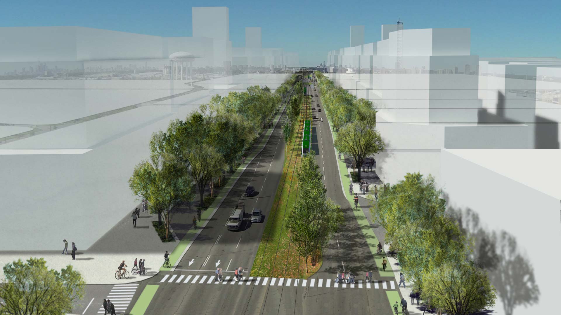
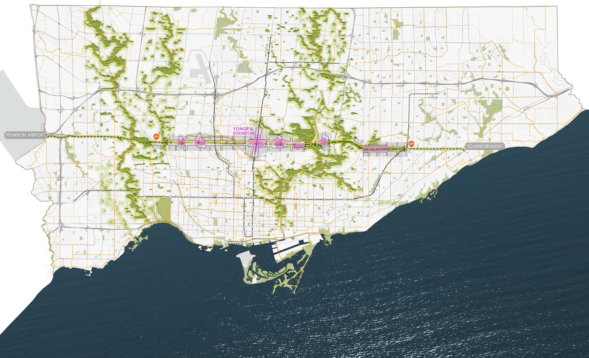
The 19 kilometre Crosstown LRT will run underground between Black Creek in the west and Laird in the east, and at-grade from Don Mills to Kennedy Station. EGLINTONconnects is complementary to Metrolinx’s work, investigating ways to take advantage of new transit infrastructure along Eglinton.
Brook McIlroy, in association with planningAlliance, HDR, and Antoine Grumbach, was lead consultant on EGLINTONconnects; Brook McIlroy’s role also included overall project management. The two-year process included over 60 public engagement events, and more that 5,000 people participated in online and in-person activities.
The Study provides detailed recommendations for Travelling, Greening and Building Eglinton. Key outcomes include:
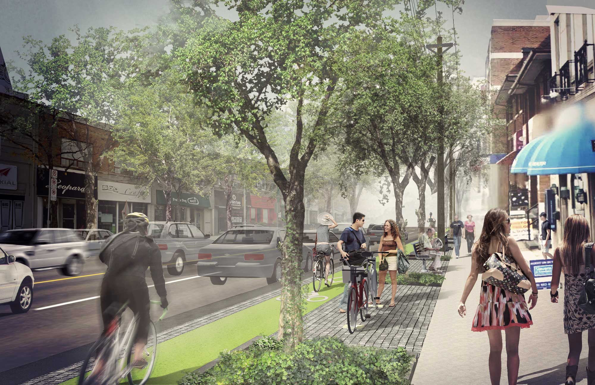
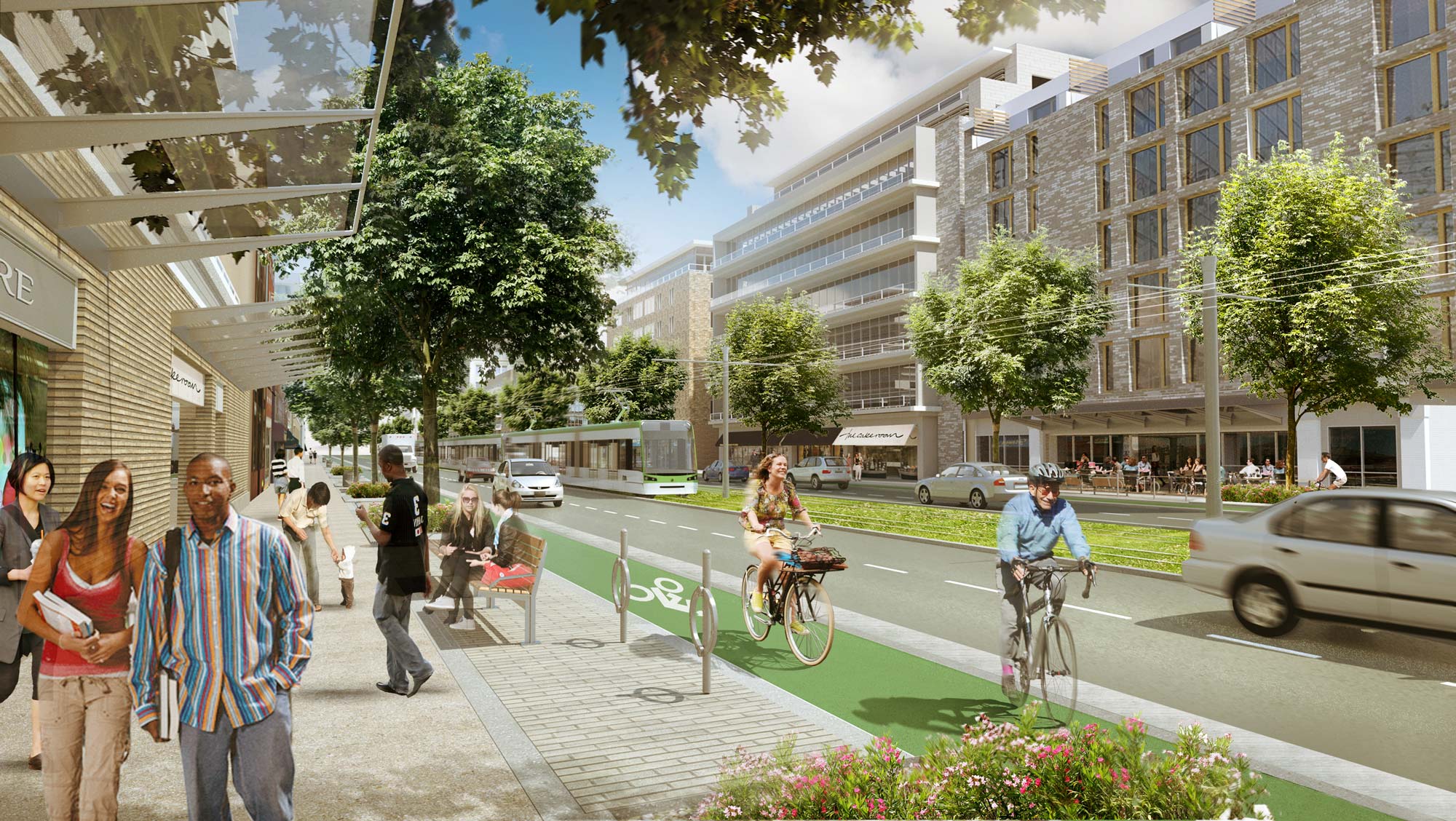
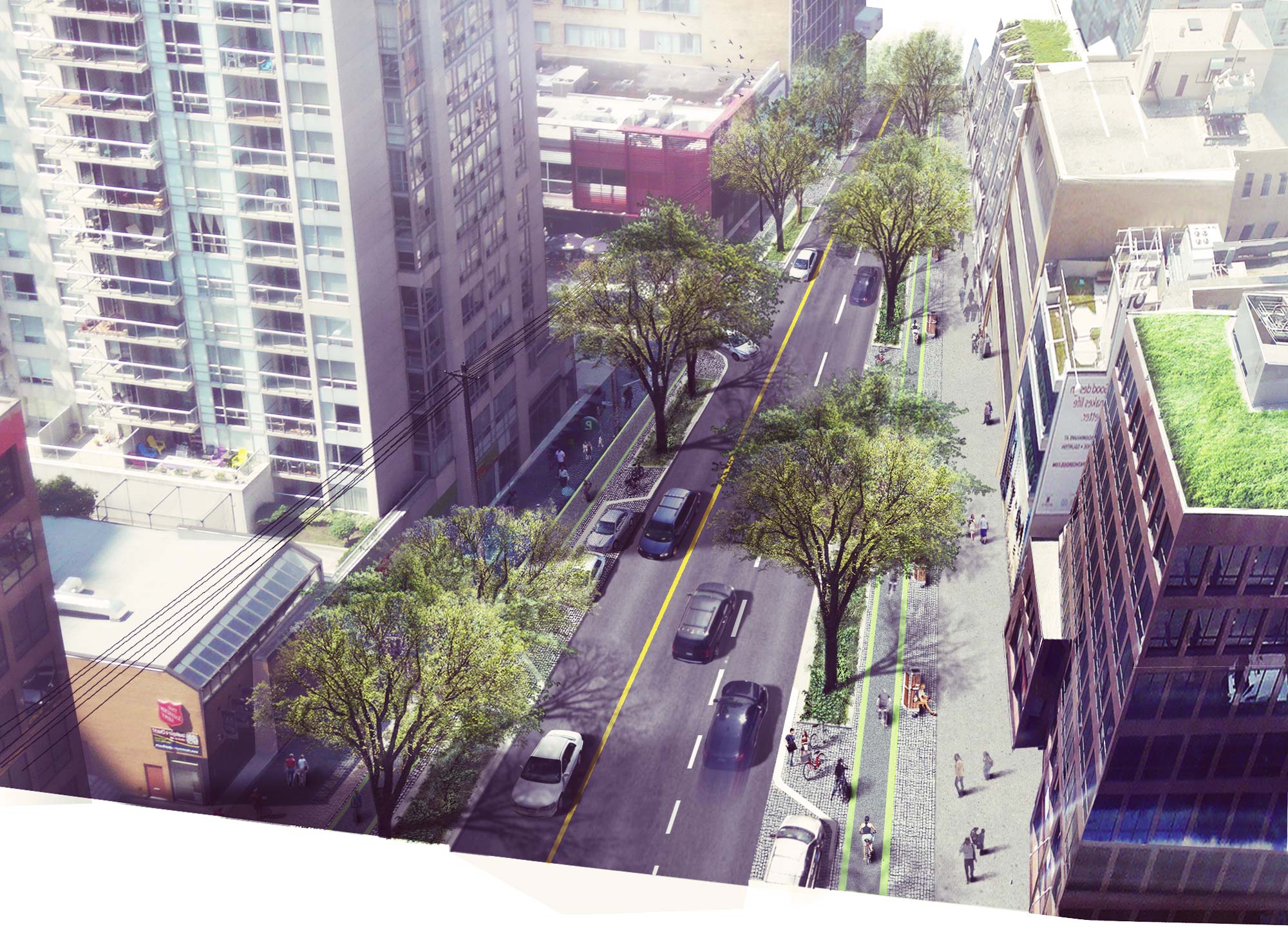
- An Environmental Assessment that provides a design for Eglinton Avenue that will maintain on-street parking and vehicular capacity, as well as providing wide sidewalks and Toronto’s longest separated bike lanes
- A Streetscape and Public Realm Plan that identifies opportunities for civic spaces and plazas, particularly at LRT Stations, new landscaping, parks and new trail connections
- A green/planted trackway for at-grade portions of the LRT
- Updates to the City’s Zoning-By-Law to allow mid-rise buildings on approximately 26% of the corridor
- Urban design principles and objectives for six key focus areas that will see major redevelopment


